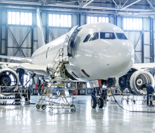
Adelaide Airport has become the first airport in Australia and the second international airport in the world which is the other one? to feature in Google Maps using its indoor ‘Street View’ technology.
The navigation works like Street View, letting viewers explore both the departures and arrivals levels of Adelaide Airport’s main terminal building, T1.
The technology, available through the airport’s Google Business Photos initiative, also allows users to ‘walk’ down one of the aerobridges and out alongside the edge of the runway in a 360-degree experience.
Google photographer, Carlos Zuluaga, who shot the images, says: “Google Business Photos is being used more and more by businesses around Australia, particularly retailers, hotels and restaurants, but very few have been done on this scale. Adelaide Airport’s terminal was chosen because it’s currently the newest and most modern looking of Australia’s airports, so the images look very good.”
See more of Adelaide Airport before flying
23 Jul 2013 - by Tammy Sutherns
Comments | 0


