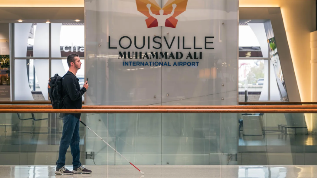
A Kentucky-based app developer, GoodMaps, will begin scanning airports, light rail systems and bus service systems to provide visually impaired or lost travellers with a free navigation service using select smartphones.
The app will use LIDAR, laser radar, to map building edges and objects, allowing the app to optically place users using their smartphone camera. The app can locate the user with a one to one-and-a-half-metre error margin. The app uses a smartphone’s accelerometer and compass functionality to track the speed and direction of the user, avoiding the use of a global positioning system and can provide directions through audio or visual cues.
GoodMaps currently has Muhammad Ali International Airport, Westchester Airport in New York State, and Portland International Airport in Oregon mapped out for use.
“This new resource means more options for travellers to get assistance and support in the way that feels right for them. With the app, they can get guidance while making their way around independently,” said Steve Nagy, Director of Airport Operations at Portland.
According to a GoodMaps spokesperson, travellers all over the world can ask their local airports to sign contracts with GoodMaps for LIDAR mapping and within four to six weeks, GoodMaps can upload the maps on to the app.
Aira is a similar app that currently works with more airports, however there is a fee to use its mapping service.